
Edmonton’s bridges are among our most familiar built heritage landmarks along the North Saskatchewan River Valley and in the city’s ravines.
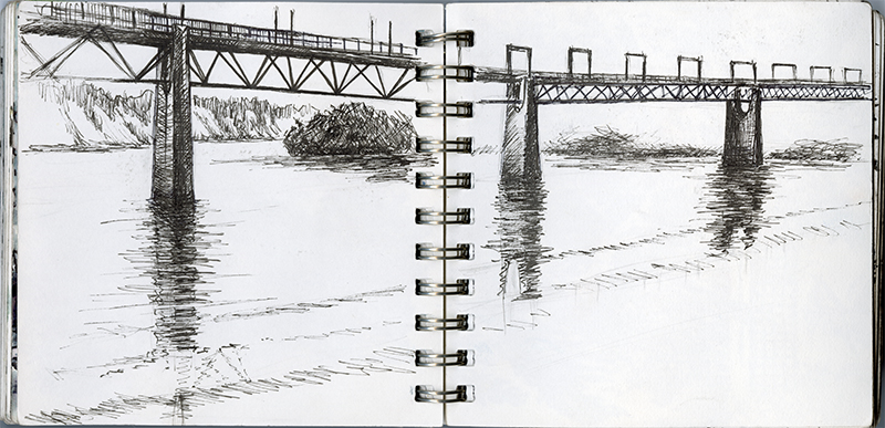
Sketch by Irina Kruglyakova, n.d.
View full-sized image
Encompassing the non-residential neighbourhoods of Mill Creek Ravine North and South, the ravine winds from Connors Road to Argyll Road. It leads down to Mill Creek, named after a flour mill established by Métis businessperson William Bird in 1878. Originally this area was integral to industry, including the mill, a railway, and meatpacking plants before being reclaimed as a green space. The park’s outdoor swimming pool, built in the mid-1950s, is still a popular recreational spot in the summer time.
The ravine is a haven for those looking to enjoy the outdoors without leaving the city. The trees here include white spruce, birch, aspen, and balsam poplar. Wildlife includes many birds ranging from the owl to the nuthatch as well as animals such as rabbits and coyotes.
The Mill Creek Trestle Bridge is one of the last pieces of physical evidence of the Edmonton, Yukon and Pacific Railway, which first connected Strathcona and Edmonton. The rail line was built from 1900 to 1902, and the bridge that spanned Mill Creek remains in its original location, parallel to 76 Avenue.
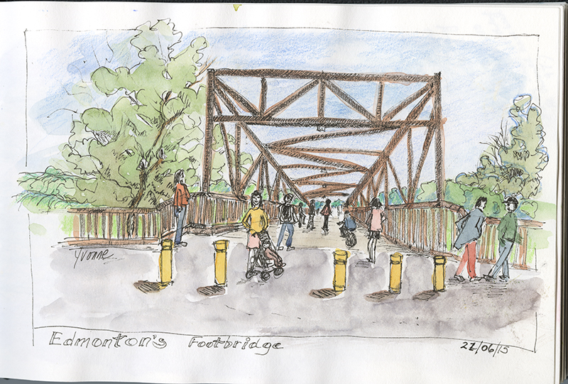
Since the late 1970s, the bridge has been a pedestrian and biking bridge. Designated in 2004 as a Municipal Historic Resource, it underwent a major rebuilding in 2018, with 25% of original wood utilised in the restoration.
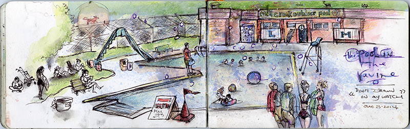
Sketch by Karen Wall, 22 June 2014
View full-sized image
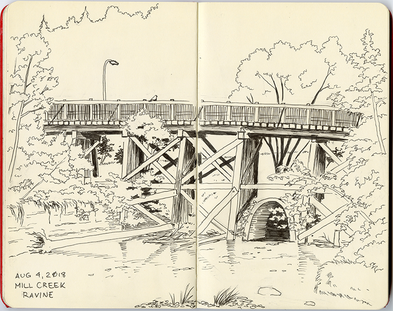
Sketch by Joanne Wojtysiak, 2 August 2018
View full-sized image
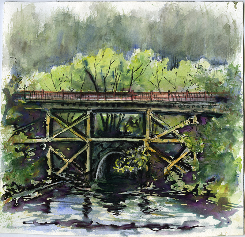
Sketch by Irina Kruglyakova, 4 August 2018
View full-sized image
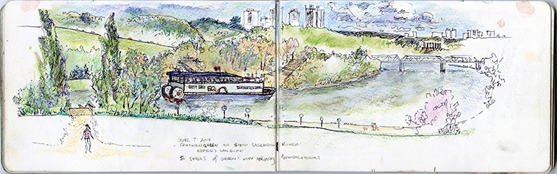
Sketch by Karen Wall, 7 June 2014
View full-sized image
The Low Level Bridge was the first, completed in 1900. It connected the two communities of Edmonton and Strathcona. A railway line was added to the bridge in 1902, and streetcars used it from 1908 to 1939.
Edmonton’s footbridges are also an important part of the community. Despite public protest, the Cloverdale Footbridge was demolished in 2016 to make way for the Valley Line LRT. Urban Timber reclaimed the wood and created hand-crafted furniture with a label to indicate that the wood came from the footbridge.
Sketch by Yvonne Rezek, 22 June 2015
View full-sized image
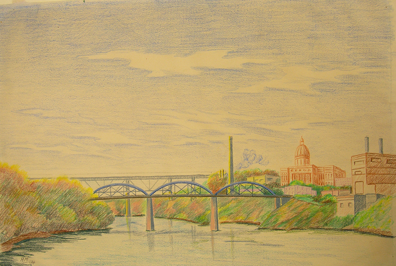
Sketch by Harold Michel, n.d., City of Edmonton Archives, EAA-6-5
View full-sized image
Indigenous peoples had long used the natural ford in the river where the 105 Street Bridge was built in 1914. The bridge replaced John Walter’s ferry operation, eventually bearing his name. The old Walterdale Bridge was demolished in 2017 and the new bridge opened in 2018.
Edmonton’s most iconic bridge is the High Level Bridge, completed in 1913. A massive steel truss bridge 777 metres long and rising 46 m above the North Saskatchewan River, it was designed by Phillips B. Motley, Engineer of Bridges for the CPR and built by John B. Gunn and Sons. It was the first bridge in Canada to carry four different modes of transportation: rail, streetcar, vehicle and pedestrian.
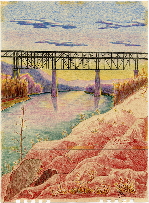
Sketch by Harold Michel, n.d., City of Edmonton Archives, EAA-6-4
View full-sized image
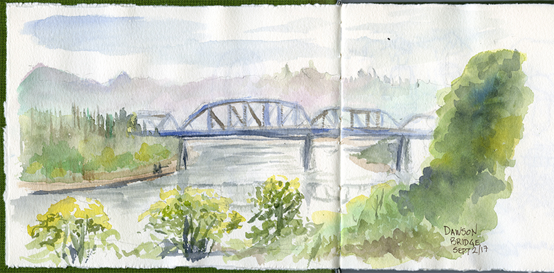
Sketch by Angie Sotiropoulos, 2 September 2017
View full-sized image
The Dawson Bridge was Edmonton’s second, opening in 1912. It was originally known as the East End Bridge, and was constructed to carry horse-drawn wagons and electric trains to the Dawson Coal Company mine located on the east bank.
Contact Us
City of Edmonton Archives
Prince of Wales Armouries, 2nd floor
10440 108 Avenue
Edmonton, Alberta
Email cms.archives@edmonton.ca