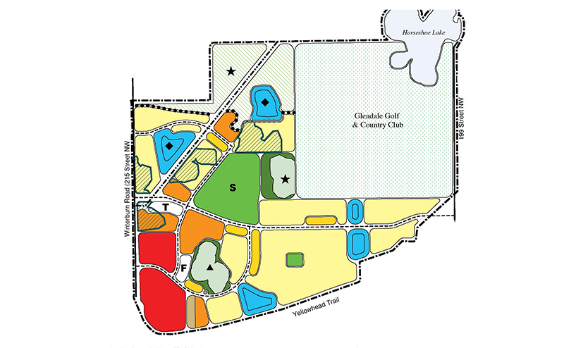
Key Features of the Plan
- Natural Areas and wetland conservation
- A future public transit centre at the west edge
- Commercial area to support future residents
- A mix of housing types from low to medium density
- A future population of approximately 4,500 people
- Several stormwater management facilities
- Open spaces and a future school site
- Maintaining the existing Glendale Golf Course & Country Club
The draft Pintail Landing Neighbourhood Structure Plan land use map illustrates the development concept. (Note: the draft map will be updated if changes are made during the review process.)