Viewing Proposed Policy and Plans
To view the final proposed district plans or existing plans to change or retire, go to the Agendas and Minutes section of the May 28, 2024 City Council Public Hearing.
Please choose between the following three options:
Skip to main menu Skip to site search Continue to current page menu and contentMain page content begins here
To view the final proposed district plans or existing plans to change or retire, go to the Agendas and Minutes section of the May 28, 2024 City Council Public Hearing.
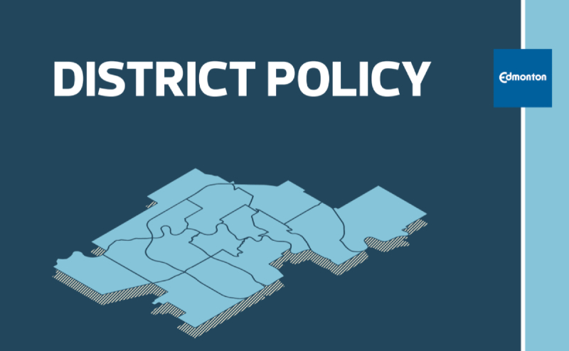
The District Policy and district plans are intended to be used together. The District Policy sets the policy foundation across the city. The 15 district plans tell us what is currently in each district, where the direction in the District Policy applies in each district, and how we expect each district to change over time.
As part of creating the District Policy and plans, we have reviewed existing geographic plans and made recommendations on which ones to keep, change, or retire so they can be replaced by, or incorporated into, the new tool of district plans.
City Council will consider the proposed District Policy and 15 district plans, as well as the existing geographic plans proposed to be retired or changed at an upcoming statutory City Council Public Hearing.
Date: Tuesday, May 28, 2024
Time: 9:30am*
Location: City Hall, Council Chambers, 1 Sir Winston Churchill Square
*Note: City Council may extend the public hearing over several days based on the number of registered speakers.
Watch Online
Watch all City Council and Committee meetings via live streaming video or on the Council Chambers YouTube channel. Captions for deaf or hard-of-hearing persons are available on both live streams.
To view the final plans, bylaws and accompanying reports, locate the City Council public hearing date (May 28, 2024) in the Agenda and Meetings and then select the agenda link to view.
There are 16 agenda items. The first item is for the proposed District Policy, which contains most of the policy direction for all districts, such as appropriate building heights for nodes and corridors.
The following 15 agenda items are for each proposed district plan, which show how the citywide District Policy directions are applied in each district.
The existing geographic plans proposed to be changed or retired have been grouped together by district and will be dealt with as part of their related district plan agenda item.
Edmontonians are encouraged to register in advance to speak at the public hearing.
When registering to speak, it is recommended you sign up for the District Policy agenda item. If you wish to speak about the content of a specific district plan(s), you may also register to speak to that specific district plan agenda item(s).
Speakers for each agenda item will be grouped into panels based on registration order and whether they are speaking in support or non-support. For each agenda item, panels of people speaking in support and panels of people speaking in non-support will alternate. Each speaker will have up to 5 minutes.
Review our Quick Guide to Land Use Statutory Public Hearings to learn more about participating.
Read the Overview of Changes 2024 to learn more about what’s changed since December 2023. Changes are reflected in the final proposed Policy and plans on the public hearing agenda.
Hang a poster or distribute a postcard.
Following the May public hearing, the District Policy and Plans must go to the Edmonton Metropolitan Region Board for approval under the Regional Evaluation Framework. They will then return to City Council in fall 2024. If adopted by City Council, the Policy and plans will come into effect immediately.
A number of changes were made to the proposed District Policy and plans since the last round of public engagement and report to the Urban Planning committee in late 2023 (item 7.1). Read the Overview of Changes 2024 document to learn more about the changes since the 2023 draft plans. Read the Overview of Changes 2023 document for all changes made to the 2022 draft plans to create the 2023 version of the draft plans.
Some of the key changes to the proposed District Policy and plans since December 2023 include:
The proposed District Policy provides general policy direction for planning and design, mobility and growth management for all districts. It allows for a consistent policy framework, enabling an efficient and equitable approach wherein policy updates will apply citywide and growth in all areas of the city will share a common foundation.
The District Policy was drafted by:
Find the district you live in by searching your address on the map or filtering the list by neighbourhood.
| District | Boundaries | Supplementary Maps | Neighbourhoods |
|---|---|---|---|
|
|
111 Avenue NW and the North Saskatchewan River along its southern and eastern boundary, Yellowhead Trail and 127 Avenue NW to the north, and 121 Street NW and Kingsway Avenue NW to the west. | 118 Avenue District Context Maps (14MB) | Abbottsfield, Alberta Avenue, Beacon Heights, Bellevue, Bergman, Beverly Heights, Blatchford Area, Cromdale, Delton, Eastwood, Edmonton Northlands, Elmwood Park, Highlands, Montrose, Newton, Parkdale, Rundle Heights, Spruce Avenue, Virginia Park, Westwood, Yellowhead Corridor East, Yellowhead Corridor West |
|
|
North Saskatchewan River along its southern and eastern boundary, 142 Street NW to the west and Yellowhead Trail, 121 Street NW to Kingsway Avenue NW and 111/112 Avenue NW to the north. | Central District Context Maps (14MB) | Boyle Street, Central McDougall, Dovercourt, Downtown, Glenora, Inglewood, McCauley, North Glenora, Oliver, Prince Charles, Prince Rupert, Queen Mary Park, Riverdale, Rossdale, Sherbrooke, Westmount, Woodcroft |
|
|
Anthony Henday Drive (Highway 216) to the north, Meridian Street SW/Range Road 234 to the east, a portion of Township Road 510 and 41 Avenue SW to the south and 91 Street SW and Highway QE2 to the west. | Ellerslie District Context Maps (11MB) | Alces, Charlesworth, Decoteau Area, Ellerslie, Ellerslie Industrial, Mattson, Meltwater, Summerside, The Orchards at Ellerslie, Walker |
|
|
259 Avenue NW/Highway 37 to the north, the North Saskatchewan River and 33 Street NE to the east, Anthony Henday Drive to the south and the Canadian Forces Base (CFB) Edmonton and 66 Street NW to the west. | Horse Hill District Context Maps | Edmonton Energy and Technology Park, Rural North East Horse Hill, Evergreen, Marquis, Rural North East South Sturgeon |
|
|
137 Avenue NW and the CN Railway to the north, St. Albert Trail and 142 Street NW to the east, the North Saskatchewan River Valley to the southeast, 170 Street NW and Stony Plain Road to the southwest, and Anthony Henday Drive to the west. | Jasper Place District Context Maps (15MB) | Alberta Park Industrial, Armstrong Industrial, Bonaventure Industrial, Britannia Youngstown, Brown Industrial, Canora, Carleton Square Industrial, Crestwood, Dominion Industrial, Edmiston Industrial, Elmwood, Gagnon Estate Industrial, Garside Industrial, Glenwood, Grovenor, Hawin Park Estate Industrial, High Park, High Park Industrial, Huff Bremner Estate Industrial, Jasper Park, Kinokamau Plains Area, Laurier Heights, Lynnwood, McNamara Industrial, McQueen, Meadowlark Park, Mistatim Industrial, Mitchell Industrial, Morin Industrial, Norwester Industrial, Parkview, Patricia Heights, Poundmaker Industrial, Quesnell Heights, Rio Terrace, Sheffield Industrial, Sherwood, Stone Industrial, Sunwapta Industrial, West Jasper Place, West Meadowlark Park, West Sheffield Industrial, White Industrial, Wilson Industrial, Youngstown Industrial |
|
|
Gateway Boulevard to the west, Whitemud Drive NW to the north and Anthony Henday Drive to the east and south. | Mill Woods and Meadows District Context Maps (12MB) | Aster, Bisset, Crawford Plains, Daly Grove, Edmonton Research and Development Park, Ekota, Greenview, Hillview, Jackson Heights, Kameyosek, Kiniski Gardens, Larkspur, Laurel, Lee Ridge, Maple, Menisa, Meyokumin, Meyonohk, Michaels Park, Minchau, Parsons Industrial, Pollard Meadows, Richfield, Sakaw, Satoo, Silver Berry, South Edmonton Common, Strathcona Industrial Park, Tamarack, Tawa, Tipaskan, Tweddle Place, Weinlos, Wild Rose |
|
|
Anthony Henday Drive (Highway 216) to the north, 33 Street NE to the east, Yellowhead Trail and 127 Avenue NW to the south and 82 Street NW to the west. | Northeast District Context Maps (12MB) | Balwin, Bannerman, Belmont, Belvedere, Brintnell, Canon Ridge, Casselman, Clareview Town Centre, Clover Bar Area, Crystallina Nera East, Crystallina Nera West, Cy Becker, Delwood, Ebbers, Fraser, Gorman, Hairsine, Hollick-Kenyon, Homesteader, Industrial Heights, Kennedale Industrial, Kernohan, Kildare, Kilkenny, Kirkness, Matt Berry, Mayliewan, McConachie, McLeod, Miller, Sifton Park, Overlanders, Ozerna, Schonsee |
|
|
St. Albert Trail NW (west), Anthony Henday Drive (north), 82 Street NW and 137 Avenue NW (east) and Yellowhead Trail and 127 Avenue NW (south). | Northwest District Context Maps (12MB) | Goodridge Corners, Griesbach, Albany, Athlone, Baturyn, Baranow, Beaumaris, Belle Rive, Caernarvon, Calder, Canossa, Carlisle, Carlton, Chambery, Cumberland, Dunluce, Eaux Claires, Elsinore, Evansdale, Glengarry, Hagmann Estate Industrial, Hudson, Kensington, Killarney, Klarvatten, Lago Lindo, Lauderdale, Lorelei, McArthur Industrial, Mistatim Industrial, Northmount, Oxford, Pembina, Rampart Industrial, Rapperswill, Rosslyn, Wellington |
|
|
41 Avenue SW to the north, Highway QE2 to the east and Highway 19 to the south. | Rabbit Hill District Context Maps | Edmonton South West, Edmonton South Central |
|
|
North Saskatchewan River to the north, Mill Creek Ravine and the CP Rail corridor east of Gateway Boulevard to the east, Whitemud Drive NW and 63 Avenue NW to the south and the North Saskatchewan River and Whitemud Creek Ravine to the west. | Scona District Context Maps (12MB) | Allendale, Argyll, Belgravia, Calgary Trail North, CPR Irvine, Empire Park, Garneau, Grandview Heights, Hazeldean, Lansdowne, Lendrum Place, Malmo Plains, Windsor Park, McKernan, Portions of Mill Creek Ravine North, Portions of Mill Creek Ravine South, Parkallen, Pleasantview, Queen Alexandra, Ritchie, Strathcona, Strathcona Junction, University of Alberta, University of Alberta Farm, Windsor Park |
|
|
North Saskatchewan River to the north, 34 Street NW and Anthony Henday Drive (Highway 216) to the east, Whitemud Drive to the south, and Mill Creek Ravine and the CP Rail corridor by Gateway Boulevard to the west. | Southeast District Context Maps (13MB) | Avonmore, Bonnie Doon, Capilano, Cloverdale, Coronet Addition Industrial, Coronet Industrial, Davies Industrial East, Davies Industrial West, East Gate Business Park, Forest Heights, Fulton Place, Gainer Industrial, Girard Industrial, Gold Bar, Holyrood, ldylwylde, Kenilworth, Lambton Industrial, Maple Ridge, Maple Ridge Industrial, McIntyre Industrial, Mill Creek Ravine North, Mill Creek Ravine South, Morris Industrial, Ottewell, Papaschase Industrial, Pylypow Industrial, River Valley Gold Bar, Roper Industrial, Rosedale Industrial, Southeast Industrial, Strathearn, Terrace Heights, Weir Industrial |
|
|
Anthony Henday Drive (Highway 216) to the north, Highway QE2 to the east and 41 Avenue SW to the south. | Southwest District Context Maps (13MB) | Allard, Ambleside, Blackburne, Blackmud Creek, Callaghan, Cashman, Cavanagh, Chappelle Area, Desrochers Area, Graydon Hill, Glenridding Heights, Glenridding Ravine, Hays Ridge Area, Heritage Valley Area, Heritage Valley Town Centre Area, Keswick, MacEwan, Paisley, Richford, River Valley Windermere, Rutherford, Windermere, Windermere Area |
|
|
Stony Plain Road NW, 170 Street NW and the North Saskatchewan River to the east and Anthony Henday Drive (Highway 216) to the south and west. | West Edmonton District Context Maps (12MB) | Aldergrove, Belmead, Callingwood North, Callingwood South, Cameron Heights, Dechene, Donsdale, Gariepy, Jamieson Place, La Perle, Lymburn, Oleskiw, Ormsby Place, Parkview, Place La Rue, River Valley Cameron, River Valley Oleskiw, Summerlea, Terra Losa, Thorncliff, Wedgewood Heights, Westridge |
|
|
Anthony Henday Drive (north), the North Saskatchewan River (east), 33 Avenue SW (south), and Winterburn Road SW/215 Street NW up to 79 Avenue SW, then west along 231 Street NW. | West Henday District Context Maps (12MB) | Breckenridge Greens, Edgemont, Glastonbury, Granville, Hawks Ridge, Kinglet Gardens, Lewis Farms Industrial, Pintail Landing, Potter Greens, River's Edge, Riverview Area, Rosenthal, Rural West Big Lake, Secord, Starling, Stewart Greens, Stillwater, Suder Greens, The Hamptons, The Uplands, Trumpeter Area, Webber Greens, Westview Village, Winterburn Industrial Area East, Winterburn Industrial Area West |
|
|
North Saskatchewan River to the northwest, Whitemud Creek and Whitemud Drive to the northeast, Gateway Boulevard to the east and Anthony Henday Drive (Highway 216) to the south. | Whitemud District Context Maps (13MB) | Aspen Gardens, Bearspaw, Blackmud Creek Ravine, Blue Quill, Blue Quill Estates, Brander Garders, Brookside, Bulyea Heights, Calgary Trail South, Carter Crest, Duggan, Ermineskin, Falconer Heights, Greenfield, Haddow, Henderson Estates, Hodgson, Keheewin, Leger, Mactaggart, Magrath Heights, Ogilvie Ridge, Ramsay Heights, Rhatigan Ridge, Rideau Park, Royal Gardens, Skyrattler, South Terwillegar, Steinhauer, Terwillegar Towne, Twin Brooks, Westbrook Estates, Whitemud Creek Ravine North, Whitemud Creek Ravine South, Whitemud Ravine Twin Brooks |
The 15 proposed district plans contain area-specific policies unique to the district and district-specific maps to show how the citywide District Policy directions are applied in each particular district.
The main function of the plans is to show what type of development is appropriate and what public infrastructure is planned in all parts of each district.
Each plan has been designed with a consistent structure for all 15 districts. Readers will connect information from the maps in the district plans to policies in the District Policy.
The City Plan was the starting point for drafting all district plans. Area-specific policies were drawn from existing plans and guidelines in effect through a detailed review of each of these documents. This review determined which policies were aligned with The City Plan and needed to be retained and incorporated into the proposed district plans.
Map content was drawn from various City strategies, the City’s open data catalogue, and data made available by EPCOR and the Government of Alberta. Feedback from Edmontonians and stakeholders was also used to change the plans to better reflect the history and local context of each district, and make the documents easier to read, understand and navigate.
Learn more about How the Plans Were Made .
To view the proposed existing plans to change or retire, go to the Agendas and Minutes section of the Council and Committee Meetings page and select the agenda for the May 28, 2024 City Council Public Hearing.
Geographic plans guide how a neighbourhood or area of the city is to be developed or redeveloped. They are often statutory (created by bylaw) and the most common examples are:
At the time of The City Plan adoption, there were over 200 local geographic plans in effect. The City reviewed them and found that many had fulfilled their purpose, or were otherwise out of alignment with the City’s overall vision for growth.
City Council repealed 75 local plans (item 3.11) in June 2021 in order to streamline and simplify land use planning. As part of the District Planning project, the remaining local plans, guidelines and policies have been reviewed, and additional repeals and changes are proposed to further align the planning system to The City Plan.
The District Policy and plans will operate as the sole land use plan under The City Plan for most parts of the city, but they also work with other statutory plans where necessary. This creates a simpler and more consistent planning system without disrupting ongoing development activity.